Delivered by Mon, Jan 05 - Wed, Jan 07Ship from New Jersey or California, United States
Service
Fast, Free Shipping & No Extra Tax
30-Day Return or Replacement
12-Month Free Warranty
Lifetime Customer Support
Pay with Ease
Trusted Delivery
Description
Shipping
Certificate
Description
In Stock - Ships within 12 hrs
Free Gifts - One Battery & Landing Pad
Starlight Night-Vision Camera
Lock Targets & Track at Night
Thermal Camera:640x512 | 16x Digital Zoom
Wide Camera: 50MP | 1/1.28" CMOS
15s Take Off | 42 Mins Max. Flight Time
A-Mesh 1.0 Multi-Drone Networking
Navigation In GPS Denied Environments
Autel SkyLink 3.0 | 12.4 miles Transmission Range
720° Obstacle Avoidance
IP43 Weather Rating | Hot-Swappable Batteries
3D Map Planning | Multiple Mission Types | Data Security
[keyfeatures]
Autel EVO Max 4N - 2025 Best Night Vision Drone
Armed with 720-degree obstacle avoidance and A-Mesh 1.0 networking support, the EVO Max Series is the next generation of intelligent, agile drones. The EVO Max 4N represents a night-ops-ready entry into the series, equipped with its starlight night vision, zoom and thermal cameras, as well as full laser ranging capabilities. With its exceptional starlight camera, the drone can operate in lighting conditions as low as 0.0001 Lux, bringing unparalleled performance in the dark. Night surveys, emergency responses, and more - all possible with the EVO Max 4N.
Hybrid Sensor Payload
The EVO Max 4N payload integrates wide-angle, starlight and thermal camera with a laser rangefinder for all data capture needs and critical decision making.
Starlight Camera With an impressive 0.0001 LUX and ISO ranges from 100-450,000, it has the ability to lock and track targets at night. This camera is the ultimate tool to explore the night.
Laser Rangefinder Tap a target to get the coordinates and altitude rapidly from up to 0.75 miles away.
Thermal Camera Equipped with 640x512 high-resolution radiometric thermal imaging camera, 30fps and 16x digital zoom.
Wide Camera Autel's Moonlight Algorithm 2.0 boosts post processing and allows the pilot to capture crisp, detailed images in low-light environments. Video: support 4K 30fps, max ISO 64000. Photo: Moonlight mode reduces noise and enhances HDR.
A Leader in Drone Intelligence
The EVO Max 4N comes equipped with a wide array of features and capabilities that range from Autonomous Path Finding, Navigation in GPS Denied Environments, and Accurate Object Identification and Tracking.
Autonomous Path Finding Autel's Autonomy Engine collects surrounding environmental data and plans 3D flight paths through complex environments such as mountains, forests, and buildings. Use cases include rapid 3D scene reconstruction, public safety overwatch, industrial inspection, and land surveying.
Navigation In GPS Denied Environments Advanced sensors allow the EVO Max 4N to navigate within hardened structures, underground, or in environments without GPS.
Accurate Object Identification And Tracking Based on Autel's AI recognition technology, the EVO Max 4N can automatically identify and lock onto different types of targets such as heat sources, moving people, or vehicles and achieve high-altitude tracking and data collection for law enforcement personnel.
No Blind Spots
Ultimate Obstacle Avoidance
EVO Max 4N is the only commercial drone that combines traditional binocular vision systems with millimeter wave radar technology. This allows the EVO Max 4N's onboard Autel Autonomy Engine to perceive objects down to 0.5 inch, eliminating blind spots and enabling operation in low light or rainy conditions.
Anti Jam, Anti Interference
The EVO Max 4N uses advanced flight control modules and algorithms specially designed to counter RFI, EMI, and GPS spoofing. This enables the EVO Max 4N to fly confidently near power lines, critical structures, and in complex areas.
Weather Rating-IP43
The EVO Max 4N has an IP43 Ingress Protection rating, which means that it is protected against solid objects greater than 1mm in diameter and against sprays of water up to 60 degrees from the vertical. This makes the drone more durable and able to withstand challenging weather conditions, making it ideal for use in a wide range of applications.
Platform Capability
EVO Max 4N redefines portability with its powerful platform and all weather design.
It comes equipped with the following features and capabilities:
42 Minutes of Maximum Flight Time
IP43 Ingress Protection Rating
27 mph Maximum Wind Resistance
23,000ft Service Ceiling
12.4 Mile Transmission Range
*Takeoff and landing can withstand wind speeds up to 27 mph (12 m/s).
Hot-Swappable Battery
Autel Max 4N hot-swappable battery system, which allows for extended flight times without the need for downtime. This system allows users to easily swap out batteries while the drone is still in operation, making it ideal for use in time-critical applications where every second counts.
A-Mesh 1.0
The Drone Industry's First Mesh Networking Technology
EVO Max 4N features the new A-Mesh system, enabling drone-to-drone autonomous communication, connection, and collaboration.
The EVO Max 4N features the new A-Mesh system, enabling drone-to-drone autonomous communication, connection, and collaboration for seamless enterprise operations.
Strong Anti-Interference The EVO Max 4N can communicate seamlessly with other drones in the vicinity, unlike a traditional chain structure. If a single drone fails or exits unexpectedly, the entire system will independently self-organize and continue to relay critical information.
Beyond-Line-of-Sight Applications With A-Mesh, multiple aircrafts in the vicinity can act as relay points to greatly improve BVLOS operation effectiveness.
Full-Fleet Control Multiple drones can be controlled autonomously by one pilot or by a group of pilots simultaneously with or without LTE coverage.
Enhanced Range Communication nodes can be placed statically on hills or poles to provide full coverage to an area, or a swarm of drones can provide mobile communication points to extend the coverage of the entire group.
Autel SkyLink 3.0
The EVO Max 4N SkyLink 3.0 system comes with 6 antennas, 4 frequency bands, AES-256 encryption*, and optional 4G integration* to provide users with the most advanced flight capabilities ever in an EVO.
12.4 Mile Image Transmission Range
1080p/60fps Real-Time Image Quality
900MHz/2.4GHz/5.2GHz/5.8GHz Frequency Bands**
<150ms Latency
*This feature will be available in a future update. **5.2GHz is only applicable for FCC, CE, and UKCA regions. 900MHz is only applicable for FCC regions.
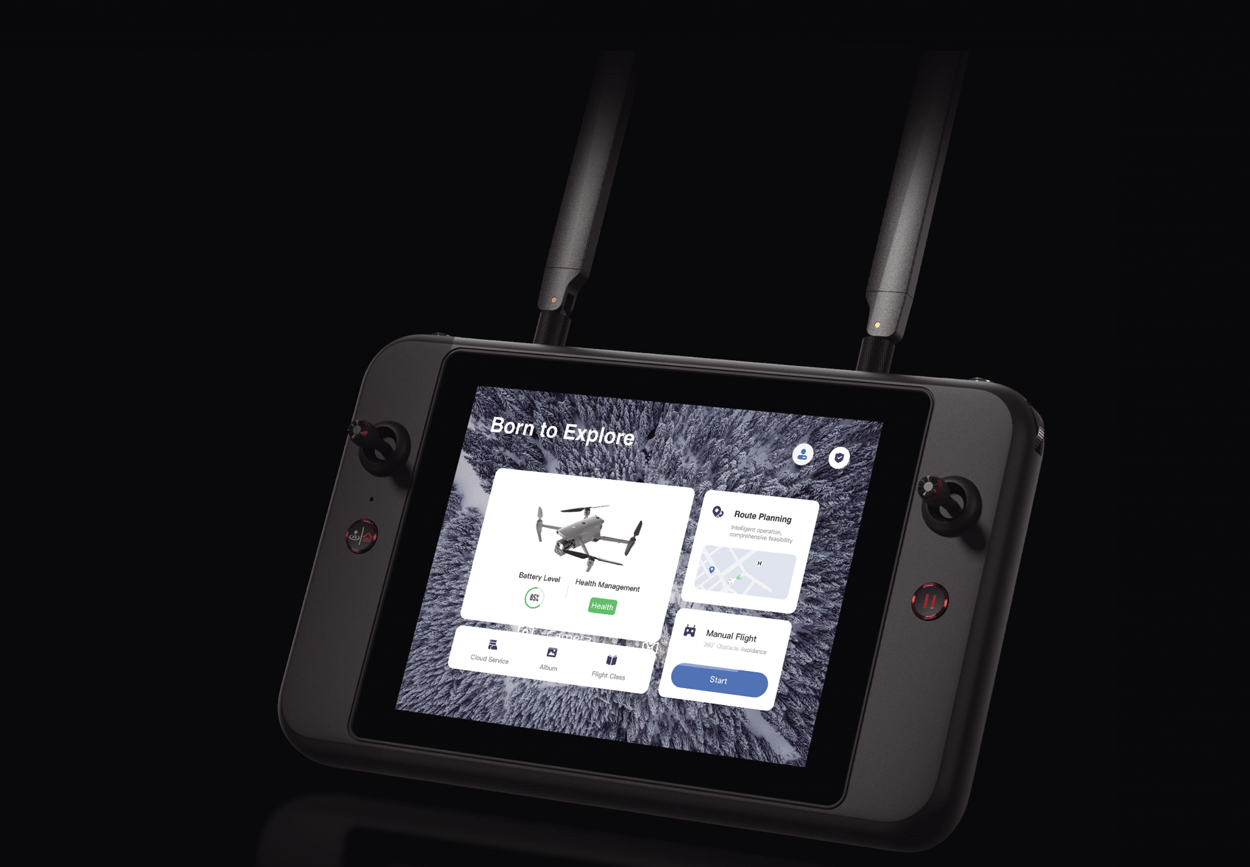
Autel Enterprise App Platform
The Autel Enterprise App is built from the ground up for industrial applications and features a brand-new interface for simple, efficient operation. Additional features and semi-autonomous modes maximize the EVO Max 4N's mission capability.
Smart Features
The EVO Max 4N comes equipped with the following intelligent features that were tailored for commercial end users:
3D Map Planning Plan, create, and execute 3D waypoint mission plans on a 3D map.
Mission Reproduction* Fly a manual or semi-autonomous mission, or string multiple missions together. The EVO Max 4N will automatically record the camera angles and replicate the mission you just flew.
Quick Mission* Temporary quick missions can be created while executing other missions, and multiple sub-missions can be stacked for enhanced flexibility.
Multiple Mission Types
The Enterprise App provides various autonomous and semi autonomous mission planning for public safety, inspection, and surveying.
Waypoint Missions Users can add waypoints for flexible, non-structured flight paths.
Rectangular Mission Supports one-click automatic generation of a rectangular flight area.
Automatic Mission (Generation And Data Capture*) Automatically produce routes by adding regional boundary points through dots or importing KML files.
Terrain Follow* Maintain relatively constant altitude from the ground for uneven or sloped terrain.
Oblique Photography Automatically plan 5 groups of routes (1 ortho + 4 oblique) according to the flight area set by the user.
Spiral Mission* Supports helical flight search in a designated area for SAR.
Polygon Mission Supports one-click automatic generation of polygon flight areas.
Vertical Scan* Perform vertical surveys for building facades, open pit walls, and towers.
Corridor Mission* Supports intuitive and effective corridor mission planning for roads, rivers, pipelines, power lines and other narrow, large-scale terrain.
*This feature will be available in a future update.
Data Security
Featuring AES 128/256 storage, radio link and network encryption for operational security.
Privacy Protection: Data involving user and aircraft information, including flight logs, locations, and account information can only be physically accessed via the aircraft locally.
Encrypted Data Storage: Supports AES-256 encryption for photos, videos, and flight logs, are password-protected.
Enhanced Live-View
Multi-channel Projection Screen* Supports simultaneous output of RGB, infrared, night vision, and wide-angle images. *This feature will be available in a future update.
Complete Remote Operations System
Used with the EVO Nest, the EVO Max series supports all-weather auto piloting for scenarios such as substations, industrial parks, and rooftops.
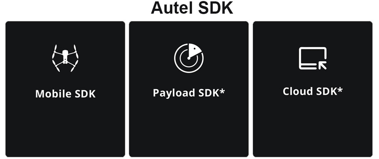
Autel SDK
The Autel SDK is open to the world, helping developers and partners reduce software and hardware development costs and jointly create a new industry ecosystem.
Mobile SDK Open UX SDK (iOS & Android) can directly call up the ready-made interactive interface.
Payload SDK* Unified interface standards support access to third-party mounts such as microphones and gas detectors.
Cloud SDK* Enables remote live broadcast and control of drones and Nests through third-party platforms or web pages.
Application
The Autel EVO Max 4N was designed for survey and inspections, search and rescue operations, public safety, and many other commercial applications.
[spec]
Autel Robotics EVO Max 4N Specs
Aircraft
Weight
3.62 lbs (1641g, battery and gimbal included)
Dimensions
562*651*147 mm (unfolded, incl. propellers) 318*400*147 mm (unfolded, excl. propellers) 257*145*131 mm (folded, excl. propellers)
Diagonal Wheelbase
1.53 ft (466mm)
Max Ascent Speed
8m/s
Max Descent Speed
6m/s
Max Horizontal Speed (windless near sea level)
23m/s *Maximum speed in Ludicrous Mode is 19m/s when operating in EU regions.
Max Service Ceiling Above Sea Level
13,124ft (4000m)
Max Flight Time (windless)
42 mins
Max Hovering Time (windless)
38 mins
Max Wind Resistance
27mph* *Takeoff and landing can withstand wind speeds up to 27 mph (12 m/s).
IP Rating
IP43
Max Tilt Angle
35°
Max Angular Velocity
Pitch: 300°/s; Yaw: 120°/s
Operating Temperature
-4°F to 122°F (-20℃ - 50℃)
Operating Frequency
2.4GHz/5.8GHz 5.2GHz (only applicable for FCC, CE, and UKCA regions). 900MHz (only applicable for FCC regions).
Vertical: ±0.1 m (Vision System enabled); ±0.3 m (GPS enabled); ±0.15 m (RTK enabled); Horizontal: ±0.15 m (Vision System enabled); ±0.3 m (GPS enabled);
Indoor: Horizontal error ≤3cm (At least have texture at one direction) Outdoor: Daytime: Within 500m flight height, horizontal error < 0.01*height Night: Manual flight is controllable within 100m flight height
Non-GPS Return-to-Home
Within 500m flight height, horizontal error of Return-to-Home point < 30cm
Automatic Obstacle Rerouting
High Speed Obstacle Rerouting: Flight speed up to 20m/s when Min. safety distance to obstacle is 1.5m High Precision Obstacle Rerouting: Flight speed could reach 3m/s when Min. safety distance to obstacle is 0.2m
Multi-target Recognition and Tracking
Target identification types: people, vehicles, boats Number of targets detected: 64 Comprehensive recognition accuracy: > 85%
Millimeter-wave Radar
Frequency
60Ghz~64Ghz
Size
38*14*2mm
Weight
2g
EIRP
18dbm
Distance Detection Range
For Obstacle Avoidance:0.2m~100m For Height Measurement:0.05m~200m
Ranging Accuracy
For Obstacle Avoidance:0.1m For Height Measurement:0.02m
5ºC to 45ºC(When the temperature is lower than 10° C (50° F), the selfheating function will be automatically enabled. Charging in a low temperature may shorten the lifetime of the battery)
Hot Swap
Support
[video]
Unlock the Power of Night Vision: Autel 4N Starlight Camera
[accessories]
Autel EVO Max 4N Fly More Combo Package List
Aircraft
x1
Battery
x3
Landing Pad
x1
Gimbal Cover
x1
64GB MicroSD Card
x1
Battery Charger & Power Cable
x1
Clockwise Propellers
x3
Counter-Clockwise Propellers
x3
Screwdriver
x1
Smart Controller V3
x1
Smart Controller Lanyard
x1
Smart Controller Cover
x1
Pair of Joysticks
x1
RC Charger
x1
RC Charging Cable
x1
Data Cable
x1
Manual
x1
Quick Start Guide
x1
Packing List
x1
Rugged Case
x1
[downloads]
Name
Download
EVO Max Series Brochure - EN.pdf
EVO Max 4N One-Sheet.pdf
EVO Max 4N Specification
Shipping
Free Worldwide Shipping
Where is my order shipped from?
We provide worldwide free shipping! And all orders will be shipped from the warehouse nearest to you and carried by DHL, FedEx, UPS, USPS, DPD, or Royal Mail according your address. Following is the location where our warehouse located at and estimate develiry date for reference.
Your Address
Shipping Location
Delivery Estimated
United States/ Canada
CA, US
NJ, US
3-5 Days
Europe
Germany
5-7 Days
United Kingdom
Leicestershire, UK
5-7 Days
Australia
Sydney, AU
7- 10 Days
Other Countries
HongKong
7-15 Days
Order Processing Time
All our order are processed and shipped out within 24 hours (excluding weekends and holidays).
After the order is shipped out and received by the carrier, we will update you by email with a Track-and-Trace code with which you can follow your package and see the remaining shipping time.
Please allow 24-48 hours for the tracking information to update.
Shipping Address Change
If you would like to change the shipping address for your order, please contact us by email with the new shipping address. Once the order is shipped, we can not alter the shipping address anymore.
International Shipping Duties & Taxes
- For international order. If the items don't ship from your local warehouse in your country/ region, you, the customer, will be responsible for the import duty, but please don't worry, We will decrease the declared value to reduce your import tax.
For more details of the Import Tax, please visit Import Duty
Returns, Refunds, and Exchanges
We provide a 30-Day Returns Service after delivery, If you are not satisfied with the item you bought or change your mind, please contact us for a return shipping address and ship all the items back to us for a refund in their original package.
For more details of the return policy, please visit our Return Policy
Certificate
Autel Authorized Dealer
Obdprice.com is Autel Authorized Exclusive Online Dealer. Products Created by Autel ® Innovation & Quality You Can Trust.